
Puerto Peñasco (also known as Rocky Point), Mexico, is located on the Sea of Cortez in the state of Sonora. It’s close proximity to Arizona (about a 4-hour drive from Phoenix and Tucson) makes it a favorite playground for US citizens who want fun in the sun and a great beach vacation.
The town was originally founded in the 1920’s when huge schools of shrimp were located off its coast. During the prohibition era, wealthy Americans came here to gamble, drink and fish. One of these visitors was Al Capone who came to enjoy the atmosphere and the freedom the town afforded. During WWII, the Mexican government allowed the US to build a paved road (Mexican Hwy. 8) from Arizona to Puerto Peñasco. This road’s purpose was to enable shipping access to the Gulf of Mexico due to the threat that the Japanese then poised. This very same road ultimately served another purpose, providing travelers a direct corridor from the deserts of Arizona to the Puerto Peñasco beaches.
The town has long served as a Spring-Break destination for thousands of college students who flock to its shores to enjoy festivities. Should you be planning your Rocky Point rental anytime around Easter, book your reservations as early as possible. Other holidays such as Christmas, Memorial Day, 4th of July and Labor Day also attract huge crowds to Puerto Peñasco.
Mexico is gaining enormous popularity as a retirement choice for US and Canadian residents who are seeking a lower cost of living in a warm and sunny environment. Retirees and RVers flock here year-round to vacation, to camp and to check out Rocky Point houses in the area.
The swimming conditions in Puerto Peñasco are considered safe and are similar to swimming in a lake. There are no riptides and the water is calm. Another bonus for the ocean-lover is the unique and extreme tidal variations of more than 20 feet. At low tide one can witness a treasure-trove of marine life and seashells.
The Sonoran Desert lies to the east of Puerto Peñasco, a land known for its ruggedness. Due to the cities geographic location, the temperatures can reach the upper 90’s/lower 100’s during the summer months. Approximately 20 miles northeast of Puerto Peñasco is the Pinacate Biosphere Reserve, a startlingly dramatic landscape of extinct volcanoes, dunes, craters and diverse wildlife. Interestingly, NASA utilized the rugged terrain found here as a training ground for the lunar astronauts as the landscape closely resembles that of the moon. If you plan on visiting the reserve, it is necessary to first register with the information center. As well, archaeologically speaking, the area is ripe for studying the San Dieguito culture, which inhabited the area some 12 thousand years ago.
At the eastern edge of town is The intercultural Center for the Study of Oceans and Deserts (CEDO). This biological field station is dedicated to studying and preserving the local marine and desert environments. They also offer tide-pool excursions and coastal desert walks. West of this center is the Cet-Mar Aquarium that features fish from the local waters along with turtles and sea lions.
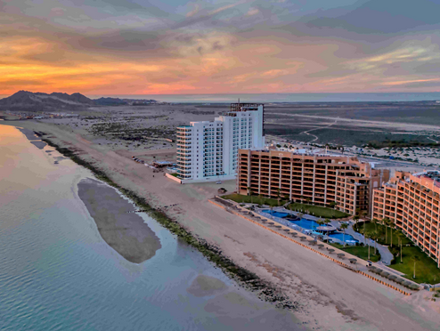
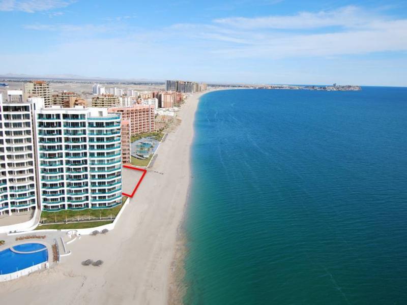
The resort is growing rapidly. There is a Puerto Peñasco hotel or accommodation to fit almost any pocketbook. You will find a couple beach hotels, more and more beach condominiums and even beachfront RV parks. In town (and close to the beach) hotels are many and of good quality. You will also find some “budget” accommodations in Old Port, on Calle 13 and in Playa Mirador areas. Rocky Point vacation rentals are available up and down the coast.
By Land
Driving is the most common method for visitors to Puerto Peñasco.
From Arizona: Cross the border at Lukeville/Sonoyta border. Puerto Peñasco is 63 miles south on Mexican Hwy. 8. The border is closed from midnight until 6am. There may be shuttle companies between Phoenix/Tucson and Puerto Peñasco.
From California: Take US Hwy. 8 east from San Diego or US Hwy. 10 east from Los Angeles area. You have the option of driving through to AZ Hwy. 85 (Gila Bend) and heading south to the Lukeville/Sonoyta border or crossing the border at either Algodones (across from California) or San Luis Rio Colorado (across from Arizona, south of Yuma).
You can then drive Mexican Hwy. 2 east through the beautiful Desierto del Altar desert. Although you are on a highway, there are not a lot of stores, services, etc. between San Luis and Sonoyta so make sure you are stocked up on supplies and water. The highway is frequently traveled so you will be able to flag someone down if your vehicle breaks down. This is also the northern entrance to the Pinacate Reserve.
Driving Distances
Phoenix…..215 miles
Tucson…..216 miles
Los Angeles…..516 miles
San Diego…..360 miles
By Air
Puerto Penasco does have an airport – Mar de Cortes International Airport.
By Sea
Puerto Peñasco is, by it’s very name, a port. There is a large marina with a commercial shrimp fleet and private docks. If you do sail into the port or area, please check with the Captain of the Port upon arrival.
ACCOMMODATIONS
ACTIVITIES & TOURS
RESTAURANTS & BARS
REAL ESTATE